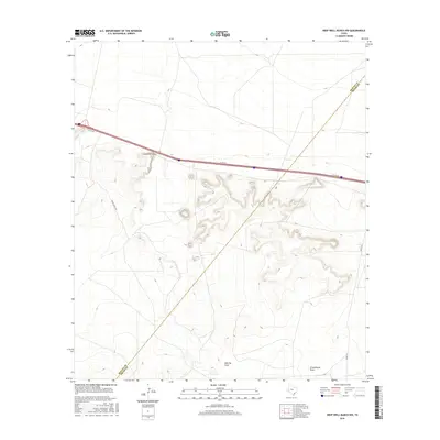
2016 Map of Deep Well Ranch NW
USGS Topo · Published 2016About this map
Lawrence Draw carves through this West Texas landscape where the high desert terrain meets the administrative boundary of Reeves and Pecos Counties. This 2016 survey illustrates a topography defined by significant drainage systems, including the southern sweep of Barrilla Draw and the distinct path of Schoolhouse Draw. The road network reflects the area's ranching and transit infrastructure, featuring Grape Ranch Rd and Hovey Rd, while the northern section is dominated by the corridor of the I10 Svc Rd. These features indicate a region where water management and transportation routes are dictated by the natural contours of the draws, providing essential context for understanding modern land use in this specific corner of the Trans-Pecos region.
Find a feature on this map
7 named features on this map. Tap any name to fly to it.
Don’t see what you’re looking for? This feature index may not catch every label — zoom into the map to look around manually.
Map Details
Editions of this 2016 Deep Well Ranch NW Map
This is the sole edition of this map. No revisions or reprints were ever made.
Other maps of this area

1894 · Fort Davis
USGS Topo · 1:125,000

1897 · Fort Davis
USGS Topo · 1:125,000

1921 · Toyah
USGS Topo · 1:125,000

1929 · Hovey
USGS Topo · 1:125,000

1931 · Barstow
USGS Topo · 1:125,000

1954 · Pecos
USGS Topo · 1:250,000

1954 · Fort Stockton
USGS Topo · 1:250,000

1955 · Saragosa
USGS Topo · 1:62,500

1957 · Pecos
USGS Topo · 1:250,000

1958 · Fort Stockton
USGS Topo · 1:250,000