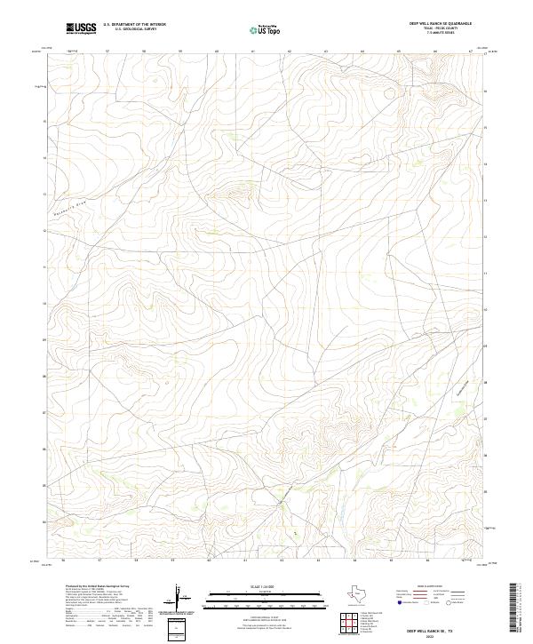
2022 Map of Deep Well Ranch SE
USGS Topo · Published 2022About this map
Upper Coyanosa Draw and Paisano Cr carve through the arid Pecos County landscape, defining the drainage patterns of this sparsely settled region. The terrain is characterized by a network of seasonal watercourses and draws that have shaped the local topography, which is largely dominated by open range and ranch land. This 2022 survey by the U.S. Geological Survey shows a network of local roads and unimproved tracks that provide access to remote areas, reflecting the land use typical of West Texas ranching country. Along the eastern edge, Coyanosa Draw and Hackberry Draw further illustrate the watershed's complexity, providing essential geographic markers in an otherwise uniform environment. The lack of named settlements or public institutions suggests a landscape of large private holdings and limited infrastructure.
Find a feature on this map
4 named features on this map. Tap any name to fly to it.
Don’t see what you’re looking for? This feature index may not catch every label — zoom into the map to look around manually.
Map Details
Editions of this 2022 Deep Well Ranch SE Map
This is the sole edition of this map. No revisions or reprints were ever made.
Other maps of this area

1929 · Hovey
USGS Topo · 1:125,000

1954 · Fort Stockton
USGS Topo · 1:250,000

1958 · Fort Stockton
USGS Topo · 1:250,000

1970 · Belding SW
USGS Topo · 1:24,000

1970 · Tucker Hill
USGS Topo · 1:24,000

1970 · Deep Well Ranch
USGS Topo · 1:24,000

1970 · Deep Well Ranch SE
USGS Topo · 1:24,000

1970 · Belding NW
USGS Topo · 1:24,000
1970 · Deep Well Ranch NW
USGS Topo · 1:24,000

1973 · Fort Stockton
USGS Topo · 1:250,000