
1970 Map of Deep Well Ranch SE
USGS Topo · Published 1973About this map
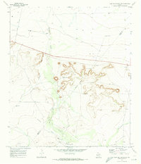
Hackberry Draw and Coyanosa Draw define the drainage patterns of this Pecos County landscape, recorded just before the 1970s. The map illustrates a ranching and extraction economy where water is the most critical resource, marked by specific family-named landmarks like the Cartlege Windmill and Mathews Windmill. These features, along with the Tule Windmill, were essential for sustaining livestock in an arid environment. Industrial activity is also evident through several scattered extraction points, including a Gas Well, a Gravel Pit, and a northern Oil Well. The sparse network of unimproved roads and fence lines shows the expansive nature of the cattle operations here, while the presence of a Drill Hole suggests ongoing exploration of the subsurface resources during this era.
Find a feature on this map
11 named features on this map. Tap any name to fly to it.
Don’t see what you’re looking for? This feature index may not catch every label — zoom into the map to look around manually.
Map Details
Editions of this 1970 Deep Well Ranch SE Map
This is the sole edition of this map. No revisions or reprints were ever made.
Other maps of this area

1929 · Hovey
USGS Topo · 1:125,000

1954 · Fort Stockton
USGS Topo · 1:250,000

1958 · Fort Stockton
USGS Topo · 1:250,000

1970 · Belding SW
USGS Topo · 1:24,000

1970 · Tucker Hill
USGS Topo · 1:24,000

1970 · Deep Well Ranch
USGS Topo · 1:24,000

1970 · Belding NW
USGS Topo · 1:24,000
1970 · Deep Well Ranch NW
USGS Topo · 1:24,000

1973 · Fort Stockton
USGS Topo · 1:250,000
1980 · Chancellor
USGS Topo · 1:24,000