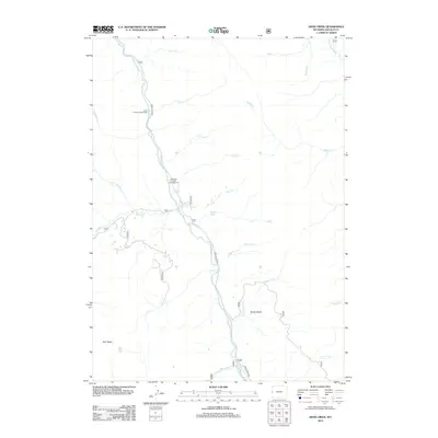
2012 Map of Deer Creek
USGS Topo · Published 2012About this map
Greys River Rd serves as the primary artery through this high-country landscape, following the winding course of the Greys River as it moves through Lincoln County. The map documents a recreation-oriented wilderness just after the turn of the 21st century, centered on the confluence of several vital waterways including Deer Cr and Murphy Cr. For those tracing the geography of the Bridger-Teton area, the survey highlights essential stopping points like Lynx Creek Campground and Murphy Creek Campground. The terrain is defined by dramatic elevation changes, notably at Grizzly Basin and the heights of Star Peaks, with remote water bodies such as Stump Lake and Lost Lake tucked into the drainages. This map preserves the contemporary state of the Wyoming forest service infrastructure and the intricate network of creeks like Hot Foot Cr and Dead Dog Cr that feed the river system.
Find a feature on this map
26 named features on this map. Tap any name to fly to it.
Don’t see what you’re looking for? This feature index may not catch every label — zoom into the map to look around manually.
Map Details
Editions of this 2012 Deer Creek Map
This is the sole edition of this map. No revisions or reprints were ever made.
Other maps of this area

1921 · Afton
USGS Topo · 1:125,000

1931 · Jackson
USGS Topo · 1:125,000

1935 · Jackson
USGS Topo · 1:125,000

1955 · Driggs
USGS Topo · 1:250,000

1955 · Preston
USGS Topo · 1:250,000

1958 · Driggs
USGS Topo · 1:250,000

1958 · Preston
USGS Topo · 1:250,000

1962 · Driggs
USGS Topo · 1:250,000

1962 · Preston
USGS Topo · 1:250,000

1963 · Ferry Peak
USGS Topo · 1:24,000