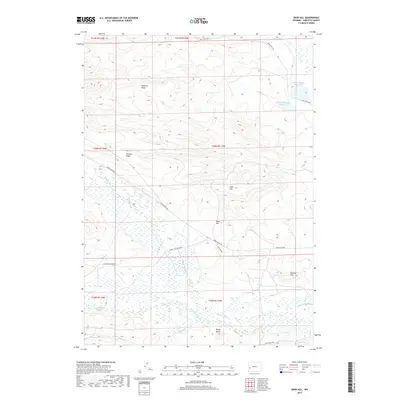
2017 Map of Deer Hill
USGS Topo · Published 2017About this map
McNinch Wash and the surrounding high country of Sublette County define this high-altitude landscape. The area is characterized by significant topographic relief, with prominent landmarks such as Deer Hill, Sand Hill, and Webster Hill rising above the drainage basins. Water management for the region's ranching interests is evident in the northern portion of the map at McNinch Number 1 Reservoir and McNinch Number 2 Reservoir.
Find a feature on this map
24 named features on this map. Tap any name to fly to it.
Don’t see what you’re looking for? This feature index may not catch every label — zoom into the map to look around manually.
Map Details
Editions of this 2017 Deer Hill Map
This is the sole edition of this map. No revisions or reprints were ever made.
Other maps of this area

1939 · Big Piney
USGS Topo · 1:125,000

1942 · Big Piney
USGS Topo · 1:125,000

1955 · Preston
USGS Topo · 1:250,000

1958 · Preston
USGS Topo · 1:250,000

1962 · Preston
USGS Topo · 1:250,000

1969 · Chimney Butte
USGS Topo · 1:24,000

1969 · Cretaceous Mountain
USGS Topo · 1:24,000
1969 · Pine Grove Ridge
USGS Topo · 1:24,000
1970 · Budd Reservoir
USGS Topo · 1:24,000
1970 · Big Piney West
USGS Topo · 1:24,000