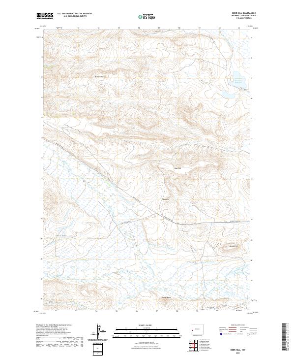
2021 Map of Deer Hill
USGS Topo · Published 2021About this map
The complex irrigation network of Wyoming's high plains is meticulously detailed here, centered on the McNinch Number 1 Reservoir and its surrounding drainage systems. The landscape is defined by a sophisticated system of water management, where named waterways like the McNinch Supply Ditch, Barbara Budd Ditch, and the Redan Ditch Second Enlargement facilitate ranching and agriculture in a region marked by distinct topographic rises. High points such as Webster Hill, Sand Hill, and Rands Butte punctuate the terrain, providing natural landmarks above the winding paths of Middle Piney Cr and Beaver Cr. This area in Sublette County shows the persistent reliance on surface water infrastructure, evidenced by numerous named ditches including the Lehmer Ditch and Homer Ditch Number 2, which trace the contours of the land to sustain local operations far from major population centers.
Find a feature on this map
35 named features on this map. Tap any name to fly to it.
Don’t see what you’re looking for? This feature index may not catch every label — zoom into the map to look around manually.
Map Details
Editions of this 2021 Deer Hill Map
This is the sole edition of this map. No revisions or reprints were ever made.
Other maps of this area

1939 · Big Piney
USGS Topo · 1:125,000

1942 · Big Piney
USGS Topo · 1:125,000

1955 · Preston
USGS Topo · 1:250,000

1958 · Preston
USGS Topo · 1:250,000

1962 · Preston
USGS Topo · 1:250,000

1969 · Chimney Butte
USGS Topo · 1:24,000

1969 · Cretaceous Mountain
USGS Topo · 1:24,000
1969 · Pine Grove Ridge
USGS Topo · 1:24,000
1970 · Budd Reservoir
USGS Topo · 1:24,000
1970 · Big Piney West
USGS Topo · 1:24,000