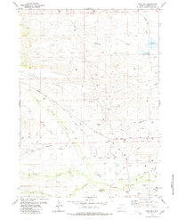
1980 Map of Deer Hill
USGS Topo · Published 1980About this map
The Ruben Oil Field dominates this 1980 survey of Sublette County, Wyoming, illustrating the intersection of historic western migration and modern resource extraction. Historic routes including the Emigrant Trail and its Lander Cutoff traverse the landscape, cutting through sections marked by numerous Gas Wells and Oil Wells. The terrain is defined by Johnson Ridge and the Deer Hill landmark, with a complex system of water management evident in the Spring Ditch, Thompson Ditch, and MC Ninch Ditch. Along the southern waters of South Piney Creek, the Jensen Cem provides a specific point of interest for genealogists tracing local family history. This map documents a high-desert environment where traditional ranching landmarks like Rands Butte and Beaver Creek coexist with industrial infrastructure like the Pipeline network.
Find a feature on this map
29 named features on this map. Tap any name to fly to it.
Don’t see what you’re looking for? This feature index may not catch every label — zoom into the map to look around manually.
Map Details
Editions of this 1980 Deer Hill Map
This is the sole edition of this map. No revisions or reprints were ever made.
Other maps of this area

1939 · Big Piney
USGS Topo · 1:125,000

1942 · Big Piney
USGS Topo · 1:125,000

1955 · Preston
USGS Topo · 1:250,000

1958 · Preston
USGS Topo · 1:250,000

1962 · Preston
USGS Topo · 1:250,000

1969 · Chimney Butte
USGS Topo · 1:24,000

1969 · Cretaceous Mountain
USGS Topo · 1:24,000
1969 · Pine Grove Ridge
USGS Topo · 1:24,000
1970 · Budd Reservoir
USGS Topo · 1:24,000
1970 · Big Piney West
USGS Topo · 1:24,000