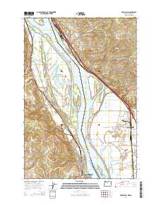
2014 Map of Deer Island
USGS Topo · Published 2014About this map
St. Helens and Columbia City anchor this section of the riverfront, where the industrial and natural landscapes of the Pacific Northwest converge. The Columbia River serves as the dominant geographic feature, separating Columbia County, Oregon, from Cowlitz County, Washington. This stretch of the river is characterized by a complex network of islands and sloughs, including the large landmass of Deer Island and the smaller Goat Island and Burke Island.
Find a feature on this map
127 named features on this map. Tap any name to fly to it.
Don’t see what you’re looking for? This feature index may not catch every label — zoom into the map to look around manually.
Map Details
Editions of this 2014 Deer Island Map
This is the sole edition of this map. No revisions or reprints were ever made.
Other maps of this area

1921 · Kalama
USGS Topo · 1:62,500

1922 · St. Helens
USGS Topo · 1:62,500

1940 · La Center
USGS Topo · 1:62,500

1941 · St Helens
USGS Topo · 1:62,500

1943 · Pigeon Springs
USGS Topo · 1:62,500

1943 · St Helens
USGS Topo · 1:62,500

1948 · Vancouver
USGS Topo · 1:250,000

1950 · Vancouver
USGS Topo · 1:250,000

1950 · Vancouver
USGS Topo · 1:250,000

1953 · Hoquiam
USGS Topo · 1:250,000