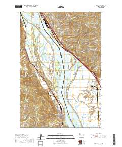
2020 Map of Deer Island
USGS Topo · Published 2020About this map
The Columbia River serves as the dominant geographic feature of this 2020 map, separating Oregon and Washington along a complex system of islands and sloughs. On the Oregon bank, the community of Columbia City and the historic settlement of Deer Island are connected by the lowlands of the Columbia City Channel and Multnomah Channel. This riverine landscape is dotted with numerous inland water bodies like Swan Lake, Thorn Lake, and Horsepasture Lake, which reflect the hydrology of the floodplain. Local history is anchored by the Kinder Cem and Masonic Cem, while the BNSF Railway tracks follow the Washington shoreline through Kalama and Woodland. The elevation rises sharply to the east at Green Mountain and Martin Bluff, offering a contrast to the marshy flats of Goat Island and Burke Island that define the central river corridor.
Find a feature on this map
133 named features on this map. Tap any name to fly to it.
Don’t see what you’re looking for? This feature index may not catch every label — zoom into the map to look around manually.
Map Details
Editions of this 2020 Deer Island Map
This is the sole edition of this map. No revisions or reprints were ever made.
Other maps of this area

1921 · Kalama
USGS Topo · 1:62,500

1922 · St. Helens
USGS Topo · 1:62,500

1940 · La Center
USGS Topo · 1:62,500

1941 · St Helens
USGS Topo · 1:62,500

1943 · Pigeon Springs
USGS Topo · 1:62,500

1943 · St Helens
USGS Topo · 1:62,500

1948 · Vancouver
USGS Topo · 1:250,000

1950 · Vancouver
USGS Topo · 1:250,000

1950 · Vancouver
USGS Topo · 1:250,000

1953 · Hoquiam
USGS Topo · 1:250,000