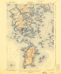
1904 Map of Deer Isle
USGS Topo · Published 1940About this map
Stonington serves as the bustling maritime hub for the region at the turn of the century, with its dense network of wharves and shorefront activity. This coastal landscape is dominated by the complex archipelago of Deer Isle and Isle au Haut, separated by the intricate Merchant Channel. Small, family-named settlements like Mountainville, Oceanville, and South Deer Isle are scattered throughout the interior and along protected coves, reflecting a community deeply tied to both the land and the sea.
Find a feature on this map
166 named features on this map. Tap any name to fly to it.
Don’t see what you’re looking for? This feature index may not catch every label — zoom into the map to look around manually.
Map Details
Editions of this 1904 Deer Isle Map
4 editions found
Other maps of this area

1902 · Castine
USGS Topo · 1:62,500

1904 · Deer Isle
USGS Topo · 1:62,500

1904 · Castine
USGS Topo · 1:62,500

1904 · Mount Desert
USGS Topo · 1:62,500

1904 · Swan Island
USGS Topo · 1:62,500

1904 · Bluehill
USGS Topo · 1:62,500

1904 · Vinalhaven
USGS Topo · 1:62,500

1905 · Penobscot Bay
USGS Topo · 1:125,000

1906 · Matinicus
USGS Topo · 1:62,500

1941 · Castine
USGS Topo · 1:62,500