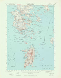
1942 Map of Deer Isle
USGS Topo · Published 1965About this map
Deer Isle and the surrounding islands of Jericho Bay and Isle au Haut Bay are documented here during the early 1940s, revealing a landscape defined by granite quarrying and maritime navigation. The coastal village of Stonington serves as the primary hub, where Quarries and local industries meet the sea near Deer Island Thorofare. Further south, the map details the northern reaches of Acadia National Park on Isle au Haut, featuring landmarks like Jerusalem Mtn and Duck Harbor Mtn.
Find a feature on this map
212 named features on this map. Tap any name to fly to it.
Don’t see what you’re looking for? This feature index may not catch every label — zoom into the map to look around manually.
Map Details
Editions of this 1942 Deer Isle Map
3 editions found

Other maps of this area

1902 · Castine
USGS Topo · 1:62,500

1904 · Deer Isle
USGS Topo · 1:62,500

1904 · Castine
USGS Topo · 1:62,500

1904 · Mount Desert
USGS Topo · 1:62,500

1904 · Swan Island
USGS Topo · 1:62,500

1904 · Bluehill
USGS Topo · 1:62,500

1904 · Vinalhaven
USGS Topo · 1:62,500

1905 · Penobscot Bay
USGS Topo · 1:125,000

1906 · Matinicus
USGS Topo · 1:62,500

1941 · Castine
USGS Topo · 1:62,500