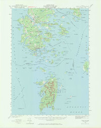
1942 Map of Deer Isle
USGS Topo · Published 1971About this map
Stonington and the surrounding granite-rich landscape of Hancock County are captured in this survey conducted during the early 1940s. The region's industrial character is evident through several marked Quarries and Quarry sites that supported the local economy. Coastal settlements such as Sunset, Oceanville, and Sunshine dot the convoluted shoreline of Deer Isle, while smaller outposts like Mountainville and The Haulover occupy the interior and narrow necks of the islands. To the south, the map details the northern reaches of Acadia National Park on Isle au Haut, showing a rugged coastal topography including Duck Harbor and Head Harbor. Genealogists will find the locations of Greenwood Cem and Forest Cem useful for tracing local family histories in this island community connected by State Route 15 and State Route 172.
Find a feature on this map
207 named features on this map. Tap any name to fly to it.
Don’t see what you’re looking for? This feature index may not catch every label — zoom into the map to look around manually.
Map Details
Editions of this 1942 Deer Isle Map
3 editions found

Other maps of this area

1902 · Castine
USGS Topo · 1:62,500

1904 · Deer Isle
USGS Topo · 1:62,500

1904 · Castine
USGS Topo · 1:62,500

1904 · Mount Desert
USGS Topo · 1:62,500

1904 · Swan Island
USGS Topo · 1:62,500

1904 · Bluehill
USGS Topo · 1:62,500

1904 · Vinalhaven
USGS Topo · 1:62,500

1905 · Penobscot Bay
USGS Topo · 1:125,000

1906 · Matinicus
USGS Topo · 1:62,500

1941 · Castine
USGS Topo · 1:62,500