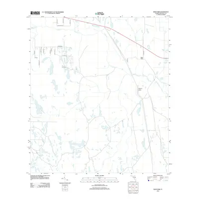
2012 Map of Deer Park
USGS Topo · Published 2012About this map
Deer Park serves as a small population center in Osceola County, set amidst a complex network of wetlands and drainage basins. The landscape is defined by its low-lying hydrology, where Crabgrass Cr and its northern tributary, West Br Crabgrass Cr, wind through the upper reaches of the map. Further south, the terrain becomes increasingly marshy, punctuated by bodies of water such as Clay Lake and Billy Lake. The local infrastructure reflects a rural agricultural character, highlighted by the Gamebird Groves Airstrip and a grid of residential and access roads including Crabgrass Rd and Jellison Rd. To the east, the drainage flows through Bull Cr and Little Cr, illustrating the subtle topographic shifts that dictate the movement of water across this central Florida plain.
Find a feature on this map
28 named features on this map. Tap any name to fly to it.
Don’t see what you’re looking for? This feature index may not catch every label — zoom into the map to look around manually.
Map Details
Editions of this 2012 Deer Park Map
This is the sole edition of this map. No revisions or reprints were ever made.
Other maps of this area

1953 · Deer Park NE
USGS Topo · 1:24,000

1953 · Holopaw SE
USGS Topo · 1:24,000

1953 · Deer Park SE
USGS Topo · 1:24,000

1953 · Kenansville
USGS Topo · 1:24,000

1953 · Deer Park NW
USGS Topo · 1:24,000

1953 · Kenansville NE
USGS Topo · 1:24,000

1953 · Deer Park
USGS Topo · 1:24,000

1953 · Holopaw
USGS Topo · 1:24,000

1953 · Lake Marian NE
USGS Topo · 1:24,000

1955 · Orlando
USGS Topo · 1:250,000