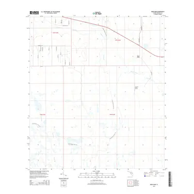
2015 Map of Deer Park
USGS Topo · Published 2015About this map
Deer Park remains a central point of reference in this interior Osceola County landscape, where the flatwoods are defined by an intricate network of slow-moving waterways and seasonal wetlands. The drainage pattern is led by the winding Bull Cr and Crabgrass Cr, which dictate the local topography alongside smaller tributaries like Tracy Branch and Yoke Branch. These natural features are interspersed with isolated water bodies such as Billy Lake and Clay Lake, highlighting the hydrologic character of the Florida peninsula's interior.
Find a feature on this map
34 named features on this map. Tap any name to fly to it.
Don’t see what you’re looking for? This feature index may not catch every label — zoom into the map to look around manually.
Map Details
Editions of this 2015 Deer Park Map
This is the sole edition of this map. No revisions or reprints were ever made.
Other maps of this area

1953 · Deer Park NE
USGS Topo · 1:24,000

1953 · Holopaw SE
USGS Topo · 1:24,000

1953 · Deer Park SE
USGS Topo · 1:24,000

1953 · Kenansville
USGS Topo · 1:24,000

1953 · Deer Park NW
USGS Topo · 1:24,000

1953 · Kenansville NE
USGS Topo · 1:24,000

1953 · Deer Park
USGS Topo · 1:24,000

1953 · Holopaw
USGS Topo · 1:24,000

1953 · Lake Marian NE
USGS Topo · 1:24,000

1955 · Orlando
USGS Topo · 1:250,000