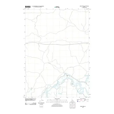
2010 Map of Deer Parks
USGS Topo · Published 2010About this map
The braided channels of the Snake River define this Idaho landscape, where a complex network of irrigation infrastructure supports the regional agriculture. The settlement of Deer Parks is positioned along the river's northern banks, situated near Kellers Island and several prominent water features including Butte Slough and Oxbow Slough. This 2010 survey illustrates the vital importance of water management in Jefferson County, clearly marking the Butte Market Lake Canal, the East Canal, and the Deer Park Canal. Transportation routes such as Hawgood Crossing Rd and Menan Butte Rd cross the terrain, connecting the dispersed rural farmsteads and agricultural plots that have shaped this portion of the Snake River Plain over the last century.
Find a feature on this map
16 named features on this map. Tap any name to fly to it.
Don’t see what you’re looking for? This feature index may not catch every label — zoom into the map to look around manually.
Map Details
Editions of this 2010 Deer Parks Map
This is the sole edition of this map. No revisions or reprints were ever made.
Other maps of this area

1948 · Rigby
USGS Topo · 1:24,000

1948 · Lewisville
USGS Topo · 1:24,000

1949 · Rigby
USGS Topo · 1:24,000

1949 · Lewisville
USGS Topo · 1:24,000

1949 · Roberts
USGS Topo · 1:62,500

1949 · Roberts
USGS Topo · 1:24,000

1950 · Roberts
USGS Topo · 1:24,000

1950 · Rigby
USGS Topo · 1:62,500
1951 · Menan Buttes
USGS Topo · 1:24,000

1951 · Plano
USGS Topo · 1:24,000