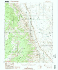
1987 Map of Deer Point
USGS Topo · Published 1987About this map
The dramatic geological spine of the Waterpocket Fold dominates this mid-1980s survey, marking a stark division between the high Circle Cliffs and the deep drainage of Halls Gulch. This landscape is defined by its transition between protected lands, with the boundary of Capitol Reef National Park meeting the Glen Canyon National Recreation Area near the Red Slide. Human influence is sparse and focused on the necessities of desert travel, evidenced by remote water sources like Fountain Tanks, Clay Seep, and Dove Spring. Notable landmarks such as Brimhall Double Arch and the Halls Creek Overlook provide specific points of reference within the complex system of mesas and canyons, including the massive Big Thompson Mesa and the branching drainages of Moody Canyon.
Find a feature on this map
25 named features on this map. Tap any name to fly to it.
Don’t see what you’re looking for? This feature index may not catch every label — zoom into the map to look around manually.
Map Details
Editions of this 1987 Deer Point Map
2 editions found
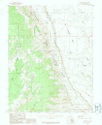
Other maps of this area

1886 · Escalante
USGS Topo · 1:250,000

1886 · Henry Mountains
USGS Topo · 1:250,000

1892 · Henry Mountains
USGS Topo · 1:250,000

1953 · Mt Pennell
USGS Topo · 1:62,500

1953 · Circle Cliffs 1 SE
USGS Topo · 1:24,000

1953 · Mt Pennell 2 SE
USGS Topo · 1:24,000

1953 · Mt Pennell 3 NW
USGS Topo · 1:24,000

1953 · Mt Pennell 3 SW
USGS Topo · 1:24,000

1953 · Mt Pennell 2 SW
USGS Topo · 1:24,000

1953 · Circle Cliffs 4 NE
USGS Topo · 1:24,000