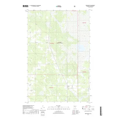
2019 Map of Deer River NE
USGS Topo · Published 2019About this map
Chippewa National Forest dominates this section of Itasca County, defined by a complex network of wetlands and small watercourses. The landscape is characterized by the meandering path of the Deer River as it flows through the southeastern corner, and the broad expanse of Rice Lake. This 2019 survey shows a region where human activity is largely confined to a grid of county roads and forest routes that navigate the marshy terrain.
Find a feature on this map
30 named features on this map. Tap any name to fly to it.
Don’t see what you’re looking for? This feature index may not catch every label — zoom into the map to look around manually.
Map Details
Editions of this 2019 Deer River NE Map
This is the sole edition of this map. No revisions or reprints were ever made.
Other maps of this area

1919 · Marcell
USGS Topo · 1:62,500

1953 · Cohasset West
USGS Topo · 1:24,000

1954 · Hibbing
USGS Topo · 1:250,000

1957 · Hibbing
USGS Topo · 1:250,000

1958 · Hibbing
USGS Topo · 1:250,000

1964 · Hibbing
USGS Topo · 1:250,000

1970 · Bowstring Lake
USGS Topo · 1:24,000

1970 · Deer River NE
USGS Topo · 1:24,000

1970 · Jessie Lake
USGS Topo · 1:24,000
1970 · Deer River
USGS Topo · 1:24,000