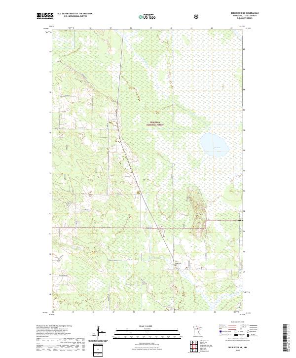
2022 Map of Deer River NE
USGS Topo · Published 2022About this map
Chippewa National Forest dominates this section of Itasca County, where the landscape is defined by extensive wetlands and complex waterway networks. The northern reach of the Deer River flows through the southeastern corner, while smaller tributaries like Grouse Cr and Evans Cr drain the surrounding timberlands. In the eastern portion, the map shows the marshy expanse of Rice Lake, a significant water body within this forested environment.
Find a feature on this map
32 named features on this map. Tap any name to fly to it.
Don’t see what you’re looking for? This feature index may not catch every label — zoom into the map to look around manually.
Map Details
Editions of this 2022 Deer River NE Map
This is the sole edition of this map. No revisions or reprints were ever made.
Other maps of this area

1919 · Marcell
USGS Topo · 1:62,500

1953 · Cohasset West
USGS Topo · 1:24,000

1954 · Hibbing
USGS Topo · 1:250,000

1957 · Hibbing
USGS Topo · 1:250,000

1958 · Hibbing
USGS Topo · 1:250,000

1964 · Hibbing
USGS Topo · 1:250,000

1970 · Bowstring Lake
USGS Topo · 1:24,000

1970 · Deer River NE
USGS Topo · 1:24,000

1970 · Jessie Lake
USGS Topo · 1:24,000
1970 · Deer River
USGS Topo · 1:24,000