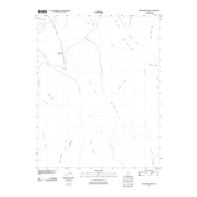
2010 Map of Deer Spring Point
USGS Topo · Published 2010About this map
The White Cliffs dominate this portion of Kane County, creating a dramatic series of escarpments that separate the Skutumpah Terrace from the elevated plateaus of Deer Spring Point and No Mans Mesa. This 2010 survey illustrates a landscape primarily shaped by topography and ranching, where isolated outposts like the Findlay Ranch and the Deer Springs Ranch Airport provide the few signs of human infrastructure. Roads such as Meadow Canyon Rd and Skutumpah Rd follow the natural contours of the terrain, weaving between deep incisions like Bullrush Gorge and Deer Range Canyon. Significant water sources, including Adams Springs and Sand Spring, are critical landmarks in this arid environment, while large grazing areas like Nephi Pasture indicate the long-standing agricultural use of the open range.
Find a feature on this map
30 named features on this map. Tap any name to fly to it.
Don’t see what you’re looking for? This feature index may not catch every label — zoom into the map to look around manually.
Map Details
Editions of this 2010 Deer Spring Point Map
This is the sole edition of this map. No revisions or reprints were ever made.
Other maps of this area

1886 · Kanab
USGS Topo · 1:250,000

1953 · Cedar City
USGS Topo · 1:250,000

1954 · Buckskin Gulch NW
USGS Topo · 1:24,000

1954 · Buckskin Gulch NE
USGS Topo · 1:24,000

1954 · Johnson NE
USGS Topo · 1:24,000

1954 · Buckskin Gulch
USGS Topo · 1:62,500

1954 · Johnson
USGS Topo · 1:62,500

1958 · Cedar City
USGS Topo · 1:250,000

1962 · Cedar City
USGS Topo · 1:250,000
1966 · Bull Valley Gorge
USGS Topo · 1:24,000