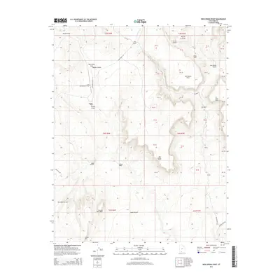
2014 Map of Deer Spring Point
USGS Topo · Published 2014About this map
Deer Springs Ranch Airport serves as a remote aviation landmark in this high-altitude landscape of southern Utah, where the topography is defined by dramatic escarpments and canyon systems. The northern half of the quadrangle is dominated by the White Cliffs and the deep incisions of Bullrush Gorge and Deer Range Canyon. These geological features give way to expansive elevated plateaus such as Calf Pasture Point and the prominent Deer Spring Point, illustrating the traditional ranching and grazing land use in the region.
Find a feature on this map
58 named features on this map. Tap any name to fly to it.
Don’t see what you’re looking for? This feature index may not catch every label — zoom into the map to look around manually.
Map Details
Editions of this 2014 Deer Spring Point Map
This is the sole edition of this map. No revisions or reprints were ever made.
Other maps of this area

1886 · Kanab
USGS Topo · 1:250,000

1953 · Cedar City
USGS Topo · 1:250,000

1954 · Buckskin Gulch NW
USGS Topo · 1:24,000

1954 · Buckskin Gulch NE
USGS Topo · 1:24,000

1954 · Johnson NE
USGS Topo · 1:24,000

1954 · Buckskin Gulch
USGS Topo · 1:62,500

1954 · Johnson
USGS Topo · 1:62,500

1958 · Cedar City
USGS Topo · 1:250,000

1962 · Cedar City
USGS Topo · 1:250,000
1966 · Bull Valley Gorge
USGS Topo · 1:24,000