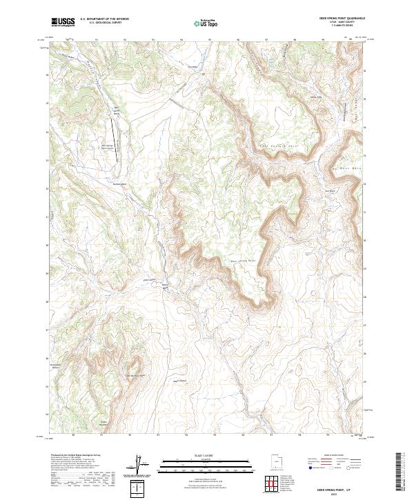
2023 Map of Deer Spring Point
USGS Topo · Published 2023About this map
Grand Staircase-Escalante National Monument dominates this portion of Kane County, preserving a landscape of dramatic vertical relief and high desert plateaus. The topography is defined by massive formations like the White Cliffs and isolated summits such as Timber Mountain, while seasonal drainages including Deer Spring Wash and Bullrush Gorge carve through the sedimentary layers. Human presence is concentrated around the Deer Springs Ranch Airport and the network of primitive roads like Skutumpah Rd and Deer Spring Point Rd that provide access to this remote interior.
Find a feature on this map
32 named features on this map. Tap any name to fly to it.
Don’t see what you’re looking for? This feature index may not catch every label — zoom into the map to look around manually.
Map Details
Editions of this 2023 Deer Spring Point Map
This is the sole edition of this map. No revisions or reprints were ever made.
Other maps of this area

1886 · Kanab
USGS Topo · 1:250,000

1953 · Cedar City
USGS Topo · 1:250,000

1954 · Buckskin Gulch NW
USGS Topo · 1:24,000

1954 · Buckskin Gulch NE
USGS Topo · 1:24,000

1954 · Johnson NE
USGS Topo · 1:24,000

1954 · Buckskin Gulch
USGS Topo · 1:62,500

1954 · Johnson
USGS Topo · 1:62,500

1958 · Cedar City
USGS Topo · 1:250,000

1962 · Cedar City
USGS Topo · 1:250,000
1966 · Bull Valley Gorge
USGS Topo · 1:24,000