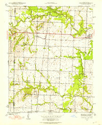
1939 Map of Deerfield
USGS Topo · Published 1953About this map
The Marmaton River meanders across the northern plains of this 1939 survey, defining a landscape at the intersection of the Kansas City Southern and Missouri Pacific railroads. Centered on the Missouri-Kansas border, the map documents a robust network of rural education, featuring numerous family-named schoolhouses such as Sunny Slope Sch, McHugh Sch, and Logan Sch that served the farming communities of Coal Township and Drywood Township.
Find a feature on this map
31 named features on this map. Tap any name to fly to it.
Don’t see what you’re looking for? This feature index may not catch every label — zoom into the map to look around manually.
Map Details
Editions of this 1939 Deerfield Map
3 editions found
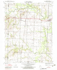
Other maps of this area

1884 · Fort Scott
USGS Topo · 1:125,000

1886 · Nevada
USGS Topo · 1:125,000

1886 · Fort Scott
USGS Topo · 1:125,000

1893 · Fort Scott
USGS Topo · 1:125,000

1894 · Nevada
USGS Topo · 1:125,000

1938 · Metz
USGS Topo · 1:24,000

1939 · Metz
USGS Topo · 1:24,000

1939 · Deerfield
USGS Topo · 1:24,000

1939 · Moundville
USGS Topo · 1:24,000

1942 · Richards
USGS Topo · 1:24,000