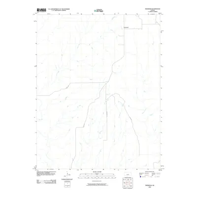
2009 Map of Deerhead
USGS Topo · Published 2009About this map
Deerhead is the focal point of this rural prairie landscape in south-central Kansas, situated at a crossroad in a region defined by its intricate drainage networks. The terrain is marked by numerous watercourses that have shaped the local geography, including Inman Creek to the northwest and the parallel flows of West Dry Creek and East Dry Creek toward the center. These streams provide a natural framework for the agricultural and ranching land that characterizes Barber County.
Find a feature on this map
11 named features on this map. Tap any name to fly to it.
Don’t see what you’re looking for? This feature index may not catch every label — zoom into the map to look around manually.
Map Details
Editions of this 2009 Deerhead Map
This is the sole edition of this map. No revisions or reprints were ever made.
Other maps of this area

1891 · Medicine Lodge
USGS Topo · 1:125,000

1892 · Coldwater
USGS Topo · 1:125,000

1893 · Medicine Lodge
USGS Topo · 1:125,000

1955 · Pratt
USGS Topo · 1:250,000

1959 · Pratt
USGS Topo · 1:250,000

1968 · Sun City SW
USGS Topo · 1:24,000

1968 · Wilmore SE
USGS Topo · 1:24,000
1973 · Pump Creek
USGS Topo · 1:24,000
1973 · Deerhead
USGS Topo · 1:24,000
1973 · Lake City
USGS Topo · 1:24,000