Loading...
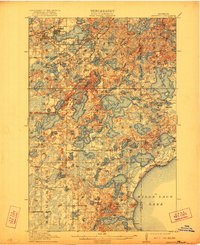
Loading map...1914 Map of Deerwood
USGS Topo · Published 1922About this map
The iron-rich landscapes of the Cuyuna Range define this 1912 survey, where the burgeoning industrial hubs of Crosby and Ironton sit at the western edge of Serpent Lake. The map reveals a dense network of early 20th-century settlements and social infrastructure, including more than twenty rural schoolhouses such as Knutson School and Eadon School, alongside small community centers like Bennettville and Garrison. The Northern Pacific railroad provides the primary transportation artery, connecting the mining towns to the broader region.
Find a feature on this map
98 named features on this map. Tap any name to fly to it.
Don’t see what you’re looking for? This feature index may not catch every label — zoom into the map to look around manually.
Map Details
Date Portrayed1914
Date Published1922
PublisherU.S. Geological Survey
Map TypeTopographic
Scale1:62,500
Physical Dimensions21.53 x 27.23 inches
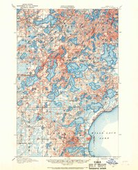
Editions of this 1914 Deerwood Map
3 editions found
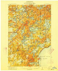
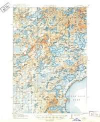
Historical Maps of Crosby Through Time
Featured Locations
Source Details
SourceU.S. Geological Survey
CopyrightPublic Domain