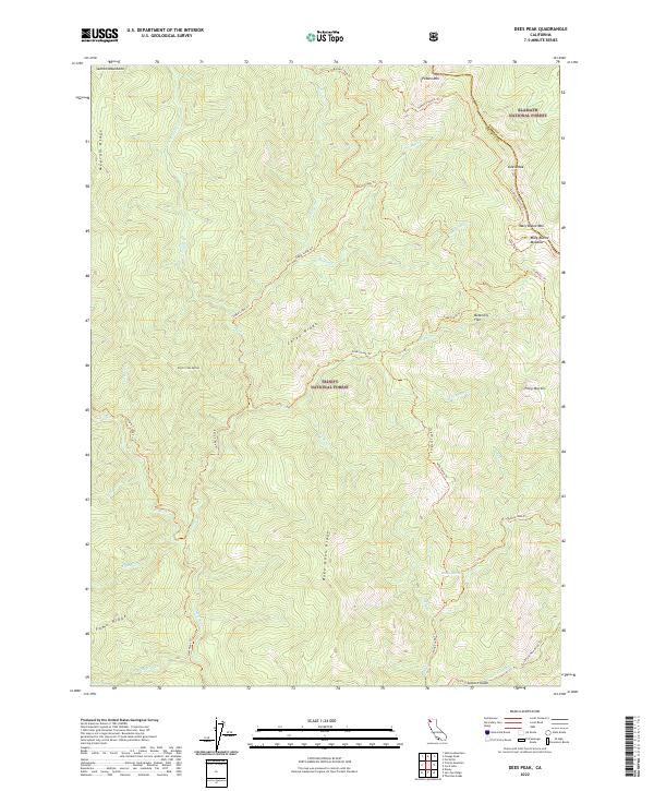
2022 Map of Dees Peak
USGS Topo · Published 2022About this map
The Salmon Mountains define the high-elevation landscape of this remote wilderness, where the border between Klamath National Forest and Trinity National Forest crosses significant peaks like Dees Peak and Mary Blaine Mtn. The terrain is marked by a complex network of ridgelines, including Carey Ridge and Bake Oven Ridge, which separate deep drainages feeding into the Trinity Wild and Scenic River system. A historical reliance on foot and pack travel is evident in the numerous established routes such as the Salmon Summit Trl and Milk Camp Trl that navigate the slopes near Mary Blaine Meadow and Butterfly Flat. This map preserves the names of localized landmarks like Virgin Creek Buttes and Pony Buttes, which served as critical orientation points for early foresters and packers.
Find a feature on this map
53 named features on this map. Tap any name to fly to it.
Don’t see what you’re looking for? This feature index may not catch every label — zoom into the map to look around manually.
Map Details
Editions of this 2022 Dees Peak Map
This is the sole edition of this map. No revisions or reprints were ever made.
Other maps of this area

1909 · Big Bar
USGS Topo · 1:96,000

1915 · Big Bar and Vicinity
USGS Topo · 1:250,000

1948 · Weed
USGS Topo · 1:250,000

1950 · Weed
USGS Topo · 1:250,000

1951 · Helena
USGS Topo · 1:62,500

1951 · Ironside Mountain
USGS Topo · 1:62,500

1955 · Salmon Mtn
USGS Topo · 1:62,500

1955 · Cecilville
USGS Topo · 1:62,500

1958 · Redding
USGS Topo · 1:250,000

1958 · Weed
USGS Topo · 1:250,000