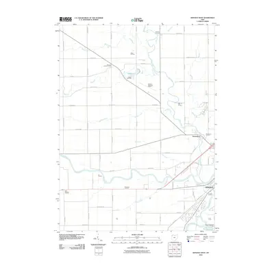
2010 Map of Defiance West
USGS Topo · Published 2010About this map
The confluence of the Maumee River and the Auglaize River anchors the landscape in this 2010 survey of the area surrounding Defiance. This region is defined by its intricate network of drainage ditches and creeks, such as Stevens Ditch, Dowe Ditch, and Buckskin Creek, which reflect the managed hydrology of Northwest Ohio's agricultural lands. The settlement of Brunersburg sits just north of the city, positioned along the banks of the Tiffin River. Local history is preserved through a high density of rural burial grounds, including the Marysdale Catholic Cemetery, Shoemaker Cemetery, and Noble and Tiffin Cemetery. To the south, Camp Lacota and its associated Camp Lakota Boy Scout Lake provide a notable recreational landmark. The presence of the Defiance Memorial Airport and Oxbow Lake further distinguishes the transition from the structured urban grid of the city to the expansive section-line road system of the surrounding township.
Find a feature on this map
65 named features on this map. Tap any name to fly to it.
Don’t see what you’re looking for? This feature index may not catch every label — zoom into the map to look around manually.
Map Details
Editions of this 2010 Defiance West Map
This is the sole edition of this map. No revisions or reprints were ever made.
Other maps of this area

1907 · Defiance
USGS Topo · 1:62,500

1909 · Defiance
USGS Topo · 1:62,500

1909 · Continental
USGS Topo · 1:62,500

1914 · Bryan
USGS Topo · 1:62,500

1914 · Paulding
USGS Topo · 1:62,500

1943 · Bryan
USGS Topo · 1:62,500

1944 · Paulding
USGS Topo · 1:62,500

1953 · Fort Wayne
USGS Topo · 1:250,000

1956 · Fort Wayne
USGS Topo · 1:250,000

1959 · Defiance East
USGS Topo · 1:24,000