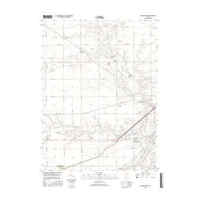
2016 Map of Defiance West
USGS Topo · Published 2016About this map
The confluence of the Maumee River, Tiffin River, and Auglaize River dominates this landscape, anchoring the city of Defiance at a vital historical waterway junction. The transition from industrial and urban layouts in the southeast to the sprawling agricultural grids of Northwest Ohio is marked by numerous legacy landmarks. Scattered across the township sections are several small family and community burial grounds, including the Shoemaker Cem, Marysdale Catholic Cem, and the Defiance County Home Cem. North of the main city center, Brunersburg sits near the winding Tiffin River, while the Defiance Memorial Airport and Oxbow Lake serve as modern landmarks. The area's drainage history is visible through a network of engineered waterways such as Dowe Ditch and Stevens Ditch, which support the intensive farming characteristic of the region.
Find a feature on this map
110 named features on this map. Tap any name to fly to it.
Don’t see what you’re looking for? This feature index may not catch every label — zoom into the map to look around manually.
Map Details
Editions of this 2016 Defiance West Map
This is the sole edition of this map. No revisions or reprints were ever made.
Other maps of this area

1907 · Defiance
USGS Topo · 1:62,500

1909 · Defiance
USGS Topo · 1:62,500

1909 · Continental
USGS Topo · 1:62,500

1914 · Bryan
USGS Topo · 1:62,500

1914 · Paulding
USGS Topo · 1:62,500

1943 · Bryan
USGS Topo · 1:62,500

1944 · Paulding
USGS Topo · 1:62,500

1953 · Fort Wayne
USGS Topo · 1:250,000

1956 · Fort Wayne
USGS Topo · 1:250,000

1959 · Defiance East
USGS Topo · 1:24,000