Loading...
Loading map...2024 Map of DeKalb
USGS Topo · Published 2024About this map
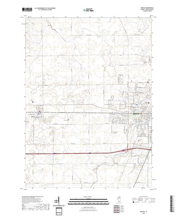
Northern Illinois University serves as a major focal point in this modern depiction of DeKalb, where the academic campus meets the residential and agricultural reaches of the county. The landscape is defined by the winding course of the South Branch Kishwaukee River and several local water bodies including Lorusso Lagoon and East Lagoon. The town of Malta sits to the west, connected to the larger hub of DeKalb by a grid of rural routes such as Twombly Rd and Bethany Rd.
Find a feature on this map
95 named features on this map. Tap any name to fly to it.
Don’t see what you’re looking for? This feature index may not catch every label — zoom into the map to look around manually.
Map Details
Date Portrayed2024
Date Published2024
PublisherU.S. Geological Survey
Map TypeTopographic
Scale1:24000
Physical Dimensions24 x 29 inches
Editions of this 2024 DeKalb Map
This is the sole edition of this map. No revisions or reprints were ever made.
Historical Maps of Malta Through Time
1 maps found
Featured Locations
- DeKalb Township, IL
- Mayfield Township, IL
- South Grove Township, IL
- DeKalb, DeKalb Township
- Malta, Malta Township
Source Details
SourceU.S. Geological Survey
CopyrightPublic Domain