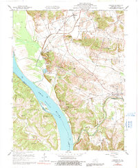
1959 Map of Dekoven
USGS Topo · Published 1991About this map
Caseyville and the industrial activity of the late 1950s define this stretch of the Ohio River, where the Illinois Central railroad and a large Conveyor system indicate the region's mid-century economic output. The landscape is a transition between the floodplains of the Shawnee National Forest in Illinois and the elevated ridges of Kentucky, including the Paris Hills and Dodge Hills. Genealogists will find a high concentration of community landmarks, such as St Ambrose Ch and Old Bethel Ch, along with numerous family and fraternal burial grounds like the Odd Fellows Cem and Mt Olive Cem. The confluence of the Tradewater River and the Ohio serves as a prominent natural boundary, separating Union and Crittenden counties and framing settlements like Grangertown and Mulfordtown.
Find a feature on this map
51 named features on this map. Tap any name to fly to it.
Don’t see what you’re looking for? This feature index may not catch every label — zoom into the map to look around manually.
Map Details
Editions of this 1959 Dekoven Map
3 editions found
Other maps of this area

1907 · Morganfield
USGS Topo · 1:62,500

1909 · Providence
USGS Topo · 1:62,500

1916 · Shawneetown
USGS Topo · 1:62,500

1916 · Fords Ferry
USGS Topo · 1:62,500

1921 · Fords Ferry
USGS Topo · 1:48,000

1925 · Cave In Rock
USGS Topo · 1:62,500

1949 · Paducah
USGS Topo · 1:250,000

1949 · Morganfield
USGS Topo · 1:24,000

1950 · Paducah
USGS Topo · 1:250,000

1951 · Sturgis
USGS Topo · 1:24,000