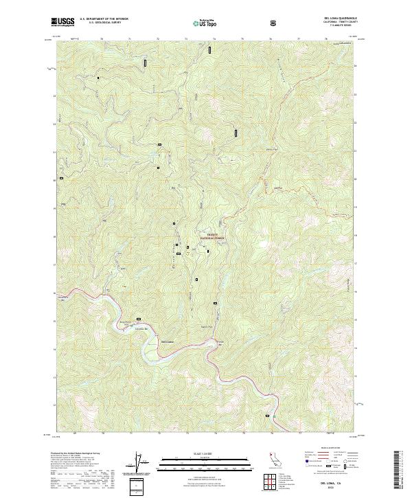
2022 Map of Del Loma
USGS Topo · Published 2022About this map
The Trinity Wild and Scenic River carves a deep path through this portion of the Trinity National Forest, defining the settlement patterns and geography of the region. Small riverside locations like Del Loma, Schneiders Bar, and French Bar are situated along the river's tight bends, reflecting a landscape where habitable land is restricted to the narrow flats and bars at the water's edge. High above the river, prominent terrain features such as Barnum Ridge and Treloar Ridge separate the many drainage gulches and creeks feeding the main waterway.
Find a feature on this map
40 named features on this map. Tap any name to fly to it.
Don’t see what you’re looking for? This feature index may not catch every label — zoom into the map to look around manually.
Map Details
Editions of this 2022 Del Loma Map
This is the sole edition of this map. No revisions or reprints were ever made.
Other maps of this area

1909 · Big Bar
USGS Topo · 1:96,000

1915 · Big Bar and Vicinity
USGS Topo · 1:250,000

1951 · Hayfork
USGS Topo · 1:62,500

1951 · Helena
USGS Topo · 1:62,500

1951 · Hyampom
USGS Topo · 1:62,500

1951 · Ironside Mountain
USGS Topo · 1:62,500

1958 · Redding
USGS Topo · 1:250,000
1982 · Jim Jam Ridge
USGS Topo · 1:24,000
1982 · Denny
USGS Topo · 1:24,000

1982 · Helena
USGS Topo · 1:24,000