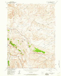
1958 Map of Del Monte Ridge
USGS Topo · Published 1960About this map
Del Monte Ridge and Sheep Mountain dominate this part of the Wyoming landscape, where the topography is defined by an intricate network of drainage draws and small-scale water management. This 1958 survey captures a high-desert environment utilized for ranching and early petroleum exploration, evidenced by multiple Oil Wells and clustered Sheep Pens.
Find a feature on this map
22 named features on this map. Tap any name to fly to it.
Don’t see what you’re looking for? This feature index may not catch every label — zoom into the map to look around manually.
Map Details
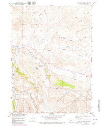
Editions of this 1958 Del Monte Ridge Map
2 editions found
Other maps of this area

1952 · Lander SE
USGS Topo · 1:24,000

1953 · Ninemile Hill
USGS Topo · 1:24,000

1953 · Bringolf Ranch
USGS Topo · 1:24,000

1953 · Gravel Spring
USGS Topo · 1:24,000

1953 · Schlichting Mountain
USGS Topo · 1:24,000

1953 · Del Monte Ridge
USGS Topo · 1:24,000

1953 · Yellowstone Ranch
USGS Topo · 1:24,000

1953 · Red Canyon
USGS Topo · 1:24,000

1953 · Weiser Pass
USGS Topo · 1:24,000

1955 · Lander
USGS Topo · 1:250,000