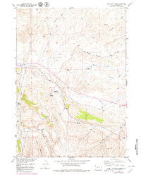
1958 Map of Del Monte Ridge
USGS Topo · Published 1979About this map
Del Monte Ridge defines the high ground of this Fremont County landscape, overlooking an intricate network of drainages and seasonal water catchments. The terrain is marked by numerous draws such as Ninemile Draw and Fivemile Draw, which feed into larger watercourses like Twin Creek and Dry Twin Creek. Evidence of early resource extraction appears via scattered Oil Well and Oil Wells locations south of Red Bluff Creek. This area's utility for ranching and land management is indicated by the significant number of man-made water features, including Sevenmile Reservoir, Carr Reservoir, Sandstone Reservoir, and Dobe Reservoir. The map also captures several named springs and forks, such as Sheep Mountain Spr and the South Fork Hall Creek, reflecting the essential nature of water sources in this arid Wyoming environment during the mid-twentieth century.
Find a feature on this map
21 named features on this map. Tap any name to fly to it.
Don’t see what you’re looking for? This feature index may not catch every label — zoom into the map to look around manually.
Map Details
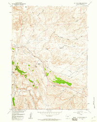
Editions of this 1958 Del Monte Ridge Map
2 editions found
Other maps of this area

1952 · Lander SE
USGS Topo · 1:24,000

1953 · Ninemile Hill
USGS Topo · 1:24,000

1953 · Bringolf Ranch
USGS Topo · 1:24,000

1953 · Gravel Spring
USGS Topo · 1:24,000

1953 · Schlichting Mountain
USGS Topo · 1:24,000

1953 · Del Monte Ridge
USGS Topo · 1:24,000

1953 · Yellowstone Ranch
USGS Topo · 1:24,000

1953 · Red Canyon
USGS Topo · 1:24,000

1953 · Weiser Pass
USGS Topo · 1:24,000

1955 · Lander
USGS Topo · 1:250,000