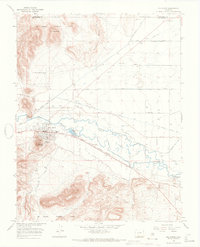
1966 Map of Del Norte
USGS Topo · Published 1968About this map
The Rio Grande winds through this Colorado landscape, where the settlement of Del Norte sits at the base of Lookout Mountain. This 1960s survey documents a highly organized agricultural valley defined by an extensive network of water management, including the Twelvemile Canal, Midland Canal, and Farmers Union Canal. To the north, the Rio Grande National Forest rises toward East Butte and the distinctive Elephant Rocks. The town's local infrastructure is well-marked, featuring a Hospital, Ranger Station, and the Del Norte Municipal and County Airport. Transportation is anchored by the Denver and Rio Grande Western railroad, which parallels the river through Evansville. Genealogists will find the Del Norte Cem and the more remote Valdese Cem useful for tracing local history in this high-altitude basin.
Find a feature on this map
40 named features on this map. Tap any name to fly to it.
Don’t see what you’re looking for? This feature index may not catch every label — zoom into the map to look around manually.
Map Details
Editions of this 1966 Del Norte Map
3 editions found
Other maps of this area

1915 · Del Norte
USGS Topo · 1:125,000

1917 · Del Norte
USGS Topo · 1:125,000

1945 · Durango
USGS Topo · 1:250,000

1953 · Durango
USGS Topo · 1:250,000

1954 · Durango
USGS Topo · 1:250,000

1961 · Durango
USGS Topo · 1:250,000

1963 · Durango
USGS Topo · 1:250,000

1964 · Sevenmile Plaza
USGS Topo · 1:24,000

1964 · Monte Vista
USGS Topo · 1:24,000

1966 · Durango
USGS Topo · 1:250,000