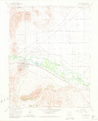
1966 Map of Del Norte
USGS Topo · Published 1981About this map
The Rio Grande defines the character of this 1966 topographic study, its waters diverted through an intricate network of irrigation ditches including the Rio Grande Canal and Farmers Union Canal. The settlement of Del Norte sits on the river's southern bank, flanked by Lookout Mountain and the Del Norte Cem. To the east, the Denver and Rio Grande Western railroad tracks run through Evansville, tracing the valley floor toward Plaza. North of the river, the landscape transitions into the distinctive geological forms of Elephant Rocks and East Butte within the Rio Grande National Forest. This map reveals the heavy reliance on seasonal water management in the San Luis Valley, visible in the numbered laterals and roads like Tenmile Road and Ninemile Road that grid the agricultural territory.
Find a feature on this map
43 named features on this map. Tap any name to fly to it.
Don’t see what you’re looking for? This feature index may not catch every label — zoom into the map to look around manually.
Map Details
Editions of this 1966 Del Norte Map
3 editions found
Other maps of this area

1915 · Del Norte
USGS Topo · 1:125,000

1917 · Del Norte
USGS Topo · 1:125,000

1945 · Durango
USGS Topo · 1:250,000

1953 · Durango
USGS Topo · 1:250,000

1954 · Durango
USGS Topo · 1:250,000

1961 · Durango
USGS Topo · 1:250,000

1963 · Durango
USGS Topo · 1:250,000

1964 · Sevenmile Plaza
USGS Topo · 1:24,000

1964 · Monte Vista
USGS Topo · 1:24,000

1966 · Durango
USGS Topo · 1:250,000