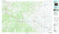
1982 Map of Del Norte
USGS Topo · Published 1983About this map
The Rio Grande cuts a prominent path through the San Luis Valley and into the high country of the San Juan Mountains in this early 1980s landscape. This map captures the region's complex transition from the alpine wilderness of the Weminuche Wilderness and the La Garita Mountains to the engineered agricultural plains of the valley floor. The Denver and Rio Grande Western railroad tracks parallel the river, connecting mountain outposts like Creede and Wagon Wheel Gap to the established hubs of Del Norte and Monte Vista. The presence of extensive irrigation systems, such as the San Luis Valley Canal, Empire Canal, and Farmers Union Canal, illustrates the intensive water management required to support local farming near settlements like Center and Homelake. Higher elevations feature landmarks like Bristol Head and Wheeler Monument, marking the high-altitude terrain of the Rio Grande National Forest.
Find a feature on this map
70 named features on this map. Tap any name to fly to it.
Don’t see what you’re looking for? This feature index may not catch every label — zoom into the map to look around manually.
Map Details
Editions of this 1982 Del Norte Map
This is the sole edition of this map. No revisions or reprints were ever made.
Other maps of this area

1905 · San Cristobal
USGS Topo · 1:125,000

1907 · San Cristobal
USGS Topo · 1:125,000

1908 · Uncompahgre
USGS Topo · 1:125,000

1911 · Uncompahgre
USGS Topo · 1:125,000

1913 · Summitville
USGS Topo · 1:125,000

1914 · Creede
USGS Topo · 1:125,000

1915 · Summitville
USGS Topo · 1:125,000

1915 · Del Norte
USGS Topo · 1:125,000

1916 · Creede
USGS Topo · 1:125,000

1917 · Del Norte
USGS Topo · 1:125,000