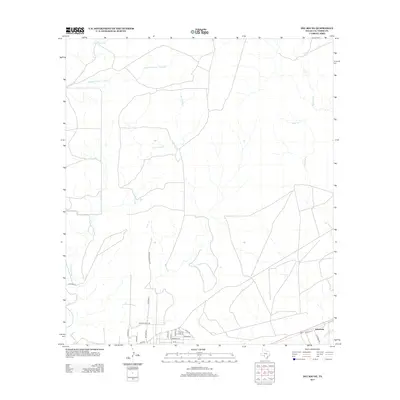
2013 Map of Del Rio NE
USGS Topo · Published 2013About this map
San Felipe Cr and its many winding tributaries define this semi-arid landscape north of the Rio Grande borderlands. The terrain is characterized by a network of seasonal drainages, including Sacatosa Cr and the Middle Fork San Pedro Cr, which carve through the brush country of Val Verde County. While the northern reaches of the sheet remain largely open ranch land or undeveloped territory, the southern portion reveals the encroaching residential expansion from the nearby regional center. This growth is evidenced by a dense grid of newer street names such as Tierra Blanca Dr, Wayman Rd, and Bonita Rd. Near the southeastern corner, the small settlement of Johnstone sits along the roadway, marking a distinct point of historical habitation amidst the modern subdivision developments and the older rural route of FM-2523.
Find a feature on this map
24 named features on this map. Tap any name to fly to it.
Don’t see what you’re looking for? This feature index may not catch every label — zoom into the map to look around manually.
Map Details
Editions of this 2013 Del Rio NE Map
This is the sole edition of this map. No revisions or reprints were ever made.
Other maps of this area

1941 · Standart
USGS Topo · 1:62,500

1943 · Standart
USGS Topo · 1:62,500

1943 · Del Rio
USGS Topo · 1:62,500

1944 · Flat Rock
USGS Topo · 1:62,500

1944 · Devils Lake
USGS Topo · 1:62,500

1958 · Del Rio
USGS Topo · 1:250,000

1964 · Del Rio
USGS Topo · 1:250,000

1972 · Del Rio SW
USGS Topo · 1:24,000

1972 · Rough Canyon SE
USGS Topo · 1:24,000

1972 · Del Rio SE
USGS Topo · 1:24,000