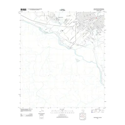
2013 Map of Del Rio SW
USGS Topo · Published 2013About this map
The Rio Grande serves as the central geographic and political anchor of this borderland area, winding past the International Bridge that connects the United States and Mexico. On the northern banks, the residential development of Cienegas Terrace and the grid of southwestern Del Rio show a landscape defined by its proximity to the water and major transport routes. Significant local history is preserved at the Old San Felipe Cem and San Felipe Cem near the eastern edge, while the industrial and travel infrastructure is highlighted by the Southern Pacific railroad line and the Del Rio International Airport. The terrain rises toward Round Mtn, overlooking the confluence of San Felipe Cr and the river. This survey captures the specialized border economy and settlement patterns where established neighborhoods and springs like San Felipe Springs meet the expansive ranching and transition lands to the south.
Find a feature on this map
98 named features on this map. Tap any name to fly to it.
Don’t see what you’re looking for? This feature index may not catch every label — zoom into the map to look around manually.
Map Details
Editions of this 2013 Del Rio SW Map
This is the sole edition of this map. No revisions or reprints were ever made.
Other maps of this area

1943 · Devils River
USGS Topo · 1:62,500

1943 · Del Rio
USGS Topo · 1:62,500

1944 · Sycamore Ranch
USGS Topo · 1:62,500

1944 · Devils River
USGS Topo · 1:62,500

1958 · Del Rio
USGS Topo · 1:250,000

1964 · Del Rio
USGS Topo · 1:250,000

1972 · Amistad Dam
USGS Topo · 1:24,000

1972 · Del Rio SW
USGS Topo · 1:24,000

1972 · Del Rio SE
USGS Topo · 1:24,000
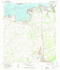
1972 · Del Rio NW
USGS Topo · 1:24,000