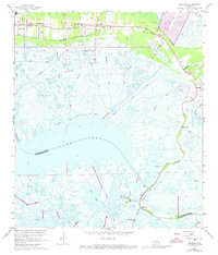
1967 Map of Delacroix
USGS Topo · Published 1973About this map
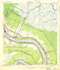
Bayou Terre aux Boeufs anchors a coastal landscape defined by the intersection of traditional bayou settlements and mid-century infrastructure projects. The corridor following the Southern Railroad contains a string of communities including St Bernard, Toca, and Kenilworth, where local life is centered around institutions like St Bernard High Sch and the True Love Cem. This era shows significant civil engineering efforts, with extensive levee construction and a control structure appearing along the intricate canal network.
Find a feature on this map
35 named features on this map. Tap any name to fly to it.
Don’t see what you’re looking for? This feature index may not catch every label — zoom into the map to look around manually.
Map Details
Editions of this 1967 Delacroix Map
4 editions found
Other maps of this area

1891 · Pointe a La Hache
USGS Topo · 1:62,500

1892 · St. Bernard
USGS Topo · 1:62,500

1892 · Pointe a La Hache
USGS Topo · 1:62,500

1893 · Shell Beach
USGS Topo · 1:62,500

1893 · Dime
USGS Topo · 1:62,500

1935 · Delacroix
USGS Topo · 1:31,680

1935 · Lake Batola
USGS Topo · 1:31,680

1939 · Shell Beach
USGS Topo · 1:62,500
1939 · Chalmette
USGS Topo · 1:31,680

1939 · Pointe a La Hache
USGS Topo · 1:62,500