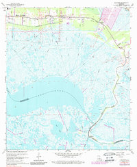
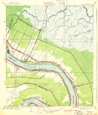
1967 Map of Delacroix
USGS Topo · Published 1989About this map
Bayou Terre aux Boeufs anchors the coastal marshlands of St. Bernard Parish, serving as the historical lifeline for settlements like St Bernard, Verret, and Reggio. This 1967 survey captures the intricate network of canals and bayous that define the region, including the expansive Lake Lery and Bayou la Loutre. The map documents the community infrastructure of the mid-20th century, from the St Bernard High Sch and Creedmore Ch to the aptly named True Love Cem in Sebastopol. The southern end of the Southern Railroad is visible, tracing a path through the wetlands toward the lower parish. Near the fishing community of Delacroix, the landscape transitions into a maze of waterways like Bayou Gentilly and Bayou Lery, illustrating the deltaic geography where land and water are constantly in flux.
Find a feature on this map
28 named features on this map. Tap any name to fly to it.
Don’t see what you’re looking for? This feature index may not catch every label — zoom into the map to look around manually.
Map Details
Editions of this 1967 Delacroix Map
4 editions found
Other maps of this area

1891 · Pointe a La Hache
USGS Topo · 1:62,500

1892 · St. Bernard
USGS Topo · 1:62,500

1892 · Pointe a La Hache
USGS Topo · 1:62,500

1893 · Shell Beach
USGS Topo · 1:62,500

1893 · Dime
USGS Topo · 1:62,500

1935 · Delacroix
USGS Topo · 1:31,680

1935 · Lake Batola
USGS Topo · 1:31,680

1939 · Shell Beach
USGS Topo · 1:62,500
1939 · Chalmette
USGS Topo · 1:31,680

1939 · Pointe a La Hache
USGS Topo · 1:62,500