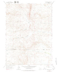
1962 Map of Delano Ranch
USGS Topo · Published 1979About this map
The Delano Ranch and surrounding family holdings define this high-plains landscape in southeastern Wyoming. Situated along the boundary where the Platte and Laramie County lines meet, the area is characterized by an intricate drainage network flowing through dissected terrain. Key waterways such as North Chugwater Creek and Threemile Creek reveal the fundamental importance of water sources to the region's ranching operations during the mid-twentieth century.
Find a feature on this map
12 named features on this map. Tap any name to fly to it.
Don’t see what you’re looking for? This feature index may not catch every label — zoom into the map to look around manually.
Map Details
Editions of this 1962 Delano Ranch Map
2 editions found
Other maps of this area

1953 · Natwick SW
USGS Topo · 1:24,000

1953 · Richeau Hills
USGS Topo · 1:24,000

1954 · Cheyenne
USGS Topo · 1:250,000

1955 · Poe Mountain
USGS Topo · 1:24,000

1955 · Indian Guide
USGS Topo · 1:24,000

1955 · Goat Mountain
USGS Topo · 1:24,000

1958 · Cheyenne
USGS Topo · 1:250,000

1962 · Farthing
USGS Topo · 1:24,000

1962 · Delano Ranch
USGS Topo · 1:24,000

1962 · Hirsig Ranch
USGS Topo · 1:24,000