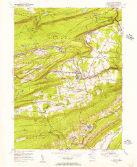
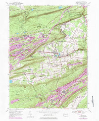
1954 Map of Delano
USGS Topo · Published 1956About this map
Schuylkill County's industrial backbone is clearly visible in this mid-century survey of the Pennsylvania anthracite coal region. The intricate rail network of the Reading and Lehigh Valley lines dominates the landscape, connecting specialized transit points like East Mahanoy Jct and Mahanoy Tunnel Sta to mining hubs such as the Primrose Mine. The map captures the dense integration of company towns and family-founded settlements, showing small population centers like Tamanend, Quakake, and Delano tucked into the valleys between Broad Mountain and Locust Mountain.
Find a feature on this map
79 named features on this map. Tap any name to fly to it.
Don’t see what you’re looking for? This feature index may not catch every label — zoom into the map to look around manually.
Map Details
Editions of this 1954 Delano Map
5 editions found
Other maps of this area

1889 · Hazleton
USGS Topo · 1:62,500

1889 · Pottsville
USGS Topo · 1:62,500

1891 · Hazleton
USGS Topo · 1:62,500

1891 · Pottsville
USGS Topo · 1:62,500

1892 · Mahanoy
USGS Topo · 1:62,500

1893 · Hazleton
USGS Topo · 1:62,500

1893 · Mahanoy
USGS Topo · 1:62,500

1909 · Hamburg
USGS Topo · 1:62,500

1911 · Hamburg
USGS Topo · 1:62,500

1944 · Pottsville
USGS Topo · 1:24,000
Featured Places
- Hometown, Rush Township
- Delano, Delano Township
- Schuylkill Township, PA
- Haucks, Rush Township
- Buck Mountain, Mahanoy Township