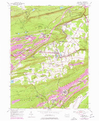
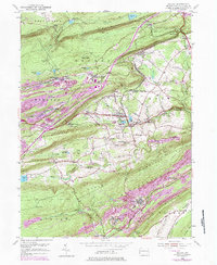
1954 Map of Delano
USGS Topo · Published 1977About this map
Conrail tracks and numerous Strip Mines define this industrial corridor of the Pennsylvania anthracite region during the mid-20th century. The landscape is a complex network of company towns and rail junctions, from the specialized Mahanoy Tunnel Sta to the dense settlements at Delano and Tuscarora. While much of the terrain is dominated by coal extraction and recovery, the social fabric of the era is preserved in the placement of local institutions like St Peters Ch, Lakeside Sch, and the St Nicholas Cem near the Mahanoy line. The northern slopes of Broad Mountain and Locust Mountain are marked by significant water management features, including Still Creek Reservoir and the Codorus Reservoir, illustrating the massive infrastructure required to support the region's mining and transit operations.
Find a feature on this map
74 named features on this map. Tap any name to fly to it.
Don’t see what you’re looking for? This feature index may not catch every label — zoom into the map to look around manually.
Map Details
Editions of this 1954 Delano Map
5 editions found
Other maps of this area

1889 · Hazleton
USGS Topo · 1:62,500

1889 · Pottsville
USGS Topo · 1:62,500

1891 · Hazleton
USGS Topo · 1:62,500

1891 · Pottsville
USGS Topo · 1:62,500

1892 · Mahanoy
USGS Topo · 1:62,500

1893 · Hazleton
USGS Topo · 1:62,500

1893 · Mahanoy
USGS Topo · 1:62,500

1909 · Hamburg
USGS Topo · 1:62,500

1911 · Hamburg
USGS Topo · 1:62,500

1944 · Pottsville
USGS Topo · 1:24,000
Featured Places
- Hometown, Rush Township
- Delano, Delano Township
- Schuylkill Township, PA
- Haucks, Rush Township
- Buck Mountain, Mahanoy Township