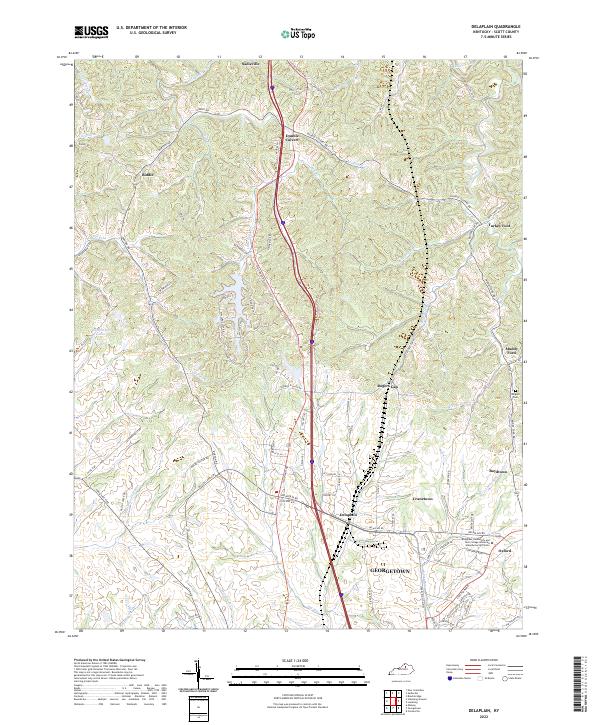
2022 Map of Delaplain
USGS Topo · Published 2022About this map
Sadieville sits at the northern edge of this Scott County landscape, where the terrain is defined by the winding course of Eagle Creek and its many tributaries like Little Eagle Creek and Wolf Br. The map reveals a transition from the rural northern uplands, dotted with small crossroads such as Biddle and Turkey Foot, to the industrial and educational development expanding north of Georgetown. This modern activity is anchored by the Bluegrass Community and Tech College Advanced Manufacturing Center near the historic community of Oxford.
Find a feature on this map
90 named features on this map. Tap any name to fly to it.
Don’t see what you’re looking for? This feature index may not catch every label — zoom into the map to look around manually.
Map Details
Editions of this 2022 Delaplain Map
This is the sole edition of this map. No revisions or reprints were ever made.
Other maps of this area

1906 · Georgetown
USGS Topo · 1:62,500

1908 · Georgetown
USGS Topo · 1:62,500

1927 · Lexington
USGS Topo · 1:48,000

1929 · Cynthiana
USGS Topo · 1:48,000

1929 · Lexington
USGS Topo · 1:62,500

1934 · Cynthiana
USGS Topo · 1:62,500

1939 · Sadieville
USGS Topo · 1:62,500

1952 · Midway
USGS Topo · 1:24,000

1953 · Sadieville
USGS Topo · 1:24,000

1953 · Breckinridge
USGS Topo · 1:24,000