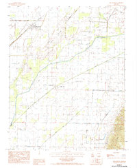
1984 Map of Delaplaine
USGS Topo · Published 1984About this map
The Missouri Pacific railroad cuts through the northeastern corner of Arkansas, anchoring the small settlement of Delaplaine. This landscape is defined by the heavy drainage patterns of the Cache River and its associated wetlands, such as Gum Slough and Big Gum Slough. The terrain shifts markedly to the east where Crowleys Ridge rises from the flat alluvial plain, providing a distinct geological boundary that influenced local settlement patterns. Smaller communities like Evening Star and Black Jack are situated along the roads that traverse the lowlands between the river and the ridges.
Find a feature on this map
13 named features on this map. Tap any name to fly to it.
Don’t see what you’re looking for? This feature index may not catch every label — zoom into the map to look around manually.
Map Details
Editions of this 1984 Delaplaine Map
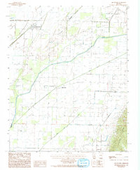
2 editions found
Other maps of this area

1932 · Walnut Ridge
USGS Topo · 1:62,500

1935 · Knobel
USGS Topo · 1:62,500

1935 · Reyno
USGS Topo · 1:62,500

1935 · Walnut Ridge
USGS Topo · 1:62,500

1940 · Gainesville
USGS Topo · 1:62,500

1941 · Knobel
USGS Topo · 1:62,500

1957 · Poplar Bluff
USGS Topo · 1:250,000

1958 · Gainesville
USGS Topo · 1:62,500

1959 · Poplar Bluff
USGS Topo · 1:250,000
1960 · Gainesville
USGS Topo · 1:62,500