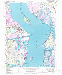
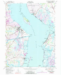
1948 Map of Delaware City
USGS Topo · Published 1984About this map
Pea Patch Island and the strategic defenses of the Delaware River anchor this mid-century coastal survey. Dominating the channel, the pentagonal Fort Delaware stands opposite Fort Mott State Park on the New Jersey shore, while the historic Finns Point National Cemetery lies just to the north. These military and commemorative sites reflect the maritime significance of the region, which is further defined by the vital link of the Chesapeake and Delaware Canal entering at Delaware City.
Find a feature on this map
69 named features on this map. Tap any name to fly to it.
Don’t see what you’re looking for? This feature index may not catch every label — zoom into the map to look around manually.
Map Details
Editions of this 1948 Delaware City Map
5 editions found
Other maps of this area

1890 · Salem
USGS Topo · 1:62,500

1890 · Bay Side
USGS Topo · 1:62,500

1894 · Bay Side
USGS Topo · 1:62,500

1898 · Salem
USGS Topo · 1:62,500

1899 · Vineland
USGS Topo · 1:125,000

1899 · Dover
USGS Topo · 1:125,000

1901 · Camden
USGS Topo · 1:125,000

1904 · Wilmington
USGS Topo · 1:62,500

1906 · Dover
USGS Topo · 1:125,000

1906 · Wilmington
USGS Topo · 1:62,500
Featured Places
- Pennsville Township, NJ
- Lower Alloways Creek Township, NJ
- Delaware City, DE
- Shingle Landing, DE
- Fort Elfsborg, Elsinboro Township