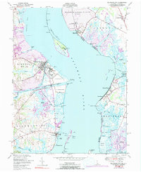
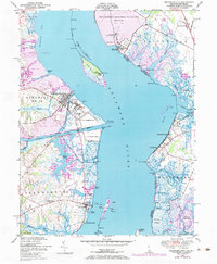
1948 Map of Delaware City
USGS Topo · Published 1991About this map
The strategic waters of the Delaware River define this coastal landscape, anchored by the military installations of Fort Delaware on Pea Patch Island and Fort Mott State Park on the New Jersey shore. At Delaware City, the critical junction of the Chesapeake and Delaware Canal meets the river, while the former Governor Bacon Health Center occupies the grounds of old Fort DuPont. The era's transportation and industrial footprint is visible in the Delaware City Branch railroad and the large tailings ponds near Reybold. Downriver, the map tracks the transition from developed riverfronts to the marshy expanses of the Killcohook National Wildlife Refuge and Supawna Meadows. Small riverside settlements like Port Penn and Augustine Beach offer a look at local life along the western bank before modern shoreline changes.
Find a feature on this map
66 named features on this map. Tap any name to fly to it.
Don’t see what you’re looking for? This feature index may not catch every label — zoom into the map to look around manually.
Map Details
Editions of this 1948 Delaware City Map
5 editions found
Other maps of this area

1890 · Salem
USGS Topo · 1:62,500

1890 · Bay Side
USGS Topo · 1:62,500

1894 · Bay Side
USGS Topo · 1:62,500

1898 · Salem
USGS Topo · 1:62,500

1899 · Vineland
USGS Topo · 1:125,000

1899 · Dover
USGS Topo · 1:125,000

1901 · Camden
USGS Topo · 1:125,000

1904 · Wilmington
USGS Topo · 1:62,500

1906 · Dover
USGS Topo · 1:125,000

1906 · Wilmington
USGS Topo · 1:62,500
Featured Places
- Pennsville Township, NJ
- Lower Alloways Creek Township, NJ
- Delaware City, DE
- Shingle Landing, DE
- Fort Elfsborg, Elsinboro Township