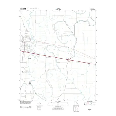
2012 Map of Delhi
USGS Topo · Published 2012About this map
Delhi and its surrounding Richland Parish landscape are defined by the winding course of Bayou Macon and a dense network of smaller waterways including Cow Bayou and Bull Calf Bayou. In 2012, this region reflects a blend of traditional river landings and modern industry, with the Delhi Oil Field situated between the town and the small settlement of Altoona. The landscape is etched with the memory of old river commerce, evidenced by names like Scott Landing, Couch Landing, and County Landing along the bayou's banks.
Find a feature on this map
80 named features on this map. Tap any name to fly to it.
Don’t see what you’re looking for? This feature index may not catch every label — zoom into the map to look around manually.
Map Details
Editions of this 2012 Delhi Map
This is the sole edition of this map. No revisions or reprints were ever made.
Other maps of this area

1935 · Baskinton
USGS Topo · 1:62,500

1935 · Hurricane
USGS Topo · 1:62,500

1935 · Waverly
USGS Topo · 1:62,500

1955 · Jackson
USGS Topo · 1:250,000

1958 · Baskinton
USGS Topo · 1:62,500

1958 · Hurricane
USGS Topo · 1:62,500

1959 · Mitchiner
USGS Topo · 1:62,500

1961 · Jackson
USGS Topo · 1:250,000

1961 · Waverly
USGS Topo · 1:62,500

1962 · Jackson
USGS Topo · 1:250,000