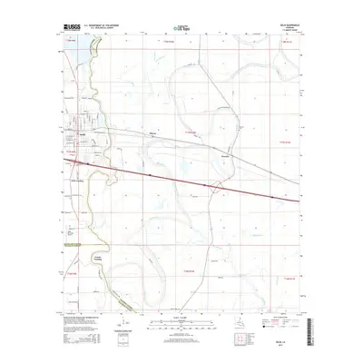
2015 Map of Delhi
USGS Topo · Published 2015About this map
Bayou Macon winds through the heart of this landscape, marking a boundary that shapes the development of eastern Louisiana settlements. The town of Delhi sits as a primary hub, its grid defined by streets like W Ohio St and E Kentucky St near the intersection of major transit corridors. To the east, the smaller community of Altoona and the rural village of Waverly are situated along the historic alignment of Highway 80, north of the modern Interstate 20. The region is characterized by a dense network of waterways including Joes Bayou, Sutt Bayou, and Mack Bayou, which have historically dictated the placement of agricultural tracts and local crossings. Genealogists will find the Waverly Cem and the locations of Scott Landing and County Landing useful for tracing family roots and commerce patterns in this river-rich portion of Richland Parish.
Find a feature on this map
81 named features on this map. Tap any name to fly to it.
Don’t see what you’re looking for? This feature index may not catch every label — zoom into the map to look around manually.
Map Details
Editions of this 2015 Delhi Map
This is the sole edition of this map. No revisions or reprints were ever made.
Other maps of this area

1935 · Baskinton
USGS Topo · 1:62,500

1935 · Hurricane
USGS Topo · 1:62,500

1935 · Waverly
USGS Topo · 1:62,500

1955 · Jackson
USGS Topo · 1:250,000

1958 · Baskinton
USGS Topo · 1:62,500

1958 · Hurricane
USGS Topo · 1:62,500

1959 · Mitchiner
USGS Topo · 1:62,500

1961 · Jackson
USGS Topo · 1:250,000

1961 · Waverly
USGS Topo · 1:62,500

1962 · Jackson
USGS Topo · 1:250,000