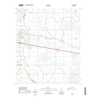
2018 Map of Delhi
USGS Topo · Published 2018About this map
Delhi serves as a central hub on this 2018 survey, where the street grid converges near the intersection of several regional routes. The map illustrates a landscape defined by its intricate hydrography, particularly the winding courses of Bayou Macon and Joes Bayou that traverse the agricultural flats. This survey is noteworthy for its depiction of local boundaries where Richland and Madison Parishes meet, as well as the transition into Franklin Parish to the south. Small settlements like Altoona and Waverly sit along the east-west transit corridor, providing a look at the rural development of the region. Local landmarks such as the Delhi Municipal Airport and the Waverly Cem offer specific points of interest for those researching community history. The network of parish roads, including the evocatively named True Love Rd, reflects the area's agricultural and social connectivity.
Find a feature on this map
76 named features on this map. Tap any name to fly to it.
Don’t see what you’re looking for? This feature index may not catch every label — zoom into the map to look around manually.
Map Details
Editions of this 2018 Delhi Map
This is the sole edition of this map. No revisions or reprints were ever made.
Other maps of this area

1935 · Baskinton
USGS Topo · 1:62,500

1935 · Hurricane
USGS Topo · 1:62,500

1935 · Waverly
USGS Topo · 1:62,500

1955 · Jackson
USGS Topo · 1:250,000

1958 · Baskinton
USGS Topo · 1:62,500

1958 · Hurricane
USGS Topo · 1:62,500

1959 · Mitchiner
USGS Topo · 1:62,500

1961 · Jackson
USGS Topo · 1:250,000

1961 · Waverly
USGS Topo · 1:62,500

1962 · Jackson
USGS Topo · 1:250,000