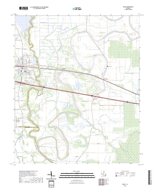
2024 Map of Delhi
USGS Topo · Published 2024About this map
Delhi serves as a primary hub where the landscapes of Richland and Madison parishes converge. This modern survey illustrates a complex hydrological network defined by the winding course of Bayou Macon and numerous tributaries including Joes Bayou, Sutt Bayou, and Mack Bayou. The town of Delhi is documented with its established street grid, including Depot St and W Ohio St, situated just west of the smaller communities of Altoona and Waverly. In the southeast corner, the Tensas River National Wildlife Refuge provides a significant preserved area of bottomland habitat. Beyond the residential centers, the map details rural landmarks such as the Waverly Cem and the Delhi Municipal Airport, alongside uniquely named local corridors like True Love Rd. The proximity of these watercourses to the road networks reflects the historical influence of the bayous on local transit and settlement patterns in this part of Louisiana.
Find a feature on this map
69 named features on this map. Tap any name to fly to it.
Don’t see what you’re looking for? This feature index may not catch every label — zoom into the map to look around manually.
Map Details
Editions of this 2024 Delhi Map
This is the sole edition of this map. No revisions or reprints were ever made.
Other maps of this area

1935 · Baskinton
USGS Topo · 1:62,500

1935 · Hurricane
USGS Topo · 1:62,500

1935 · Waverly
USGS Topo · 1:62,500

1955 · Jackson
USGS Topo · 1:250,000

1958 · Baskinton
USGS Topo · 1:62,500

1958 · Hurricane
USGS Topo · 1:62,500

1959 · Mitchiner
USGS Topo · 1:62,500

1961 · Jackson
USGS Topo · 1:250,000

1961 · Waverly
USGS Topo · 1:62,500

1962 · Jackson
USGS Topo · 1:250,000